Hanoi Map and New Hanoi District Map: Updated Guide
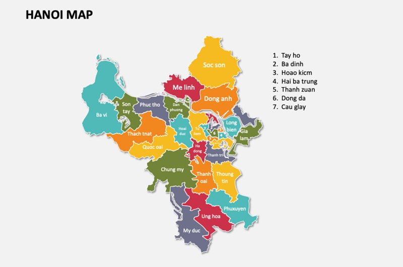
Hanoi is classified as a special urban area in Vietnam, playing an important role in promoting the socio-economic development of the country. This is also known as the city with the largest area in Vietnam with a rapid and outstanding urbanization rate. To help you get a better overview of the capital Hanoi, Maison Office will compile for you the latest map of Hanoi and maps of districts today. Follow along below!
Table of Contents
- 1. Information about Hanoi city
- 2. Administrative map of Hanoi
- 3. Administrative map of Hanoi districts
- 3.1. Map of Ba Dinh district
- 3.2. Map of Hoan Kiem district
- 3.3. Map of Tay Ho district
- 3.4. Map of Long Bien district
- 3.5. Map of Cau Giay district
- 3.6. Map of Dong Da district
- 3.7. Map of Hai Ba Trung district
- 3.8. Map of Hoang Mai district
- 3.9. Map of Thanh Xuan district
- 3.10. Map of Nam Tu Liem district
- 3.11. Map of Bac Tu Liem district
- 3.12. Map of Ha Dong district
- 3.13. Map of Son Tay town
- 3.14. Map of Soc Son district
- 3.15. Map of Dong Anh district
- 3.16. Map of Gia Lam district
- 3.17. Map of Thanh Tri district
- 3.18. Map of Me Linh district
- 3.19. Map of Ba Vi district
- 3.20. Map of Phuc Tho district
- 3.21. Map of Dan Phuong district
- 3.22. Map of Hoai Duc district
- 3.23. Map of Quoc Oai district
- 3.24. Map of Thach That district
- 3.25. Map of Chuong My district
- 3.26. Map of Thanh Oai district
- 3.27. Map of Thuong Tin district
- 3.28. Map of Phu Xuyen district
- 3.29. Map of Ung Hoa district
- 3.30. Map of My Duc district
- 4. Map of Office Buildings in Hanoi
1. Information about Hanoi city
Hanoi is the capital of the Socialist Republic of Vietnam and the largest centrally governed city in the country by area. With over 1,000 years of formation and development, Hanoi has witnessed the rise and fall of most Vietnamese feudal dynasties. As a result, it is renowned for its rich history and distinctive traditional cultural heritage.
1.1. Geographical location
Hanoi covers a total natural area of 3,358.6 square kilometers, making it the largest centrally governed city in the country since the incorporation of Ha Tay province. The capital city is located in the northwest of the Red River Delta, with precise geographical coordinates of 20°53′ – 21°23′ North latitude and 105°44′ – 106°02′ East longitude.
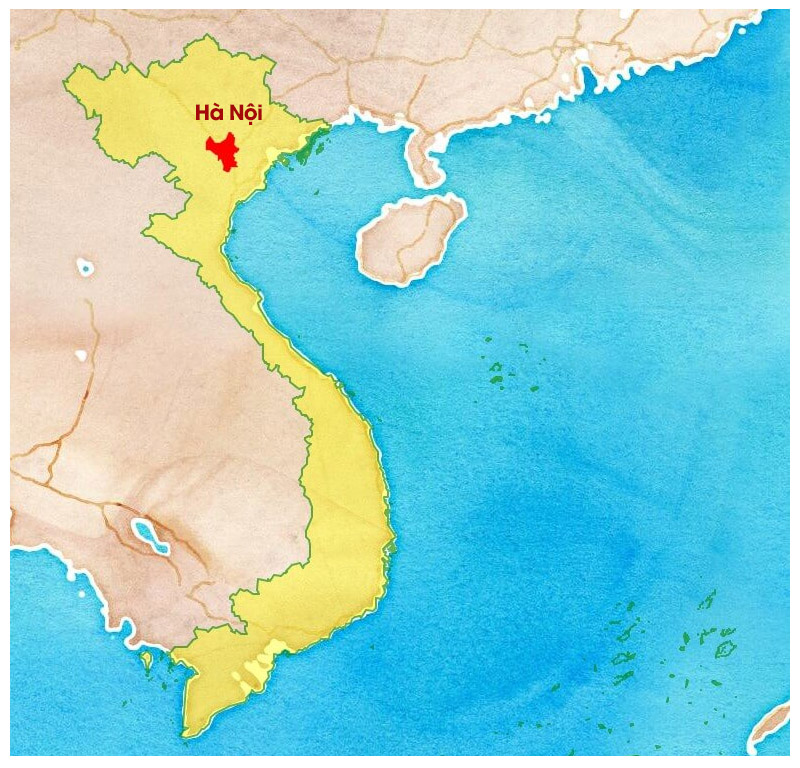
The terrain of Hanoi gradually slopes from North to South and from West to East. The plains account for three-quarters of the city’s total natural area, with the remaining higher elevations concentrated in the North and West.
- To the North, the city borders the provinces of Thai Nguyen and Vinh Phuc.
- To the South, it borders Ha Nam and Hoa Binh provinces.
- The East borders Hung Yen, Bac Giang and Bac Ninh provinces.
- To the West, Hanoi borders Phu Tho province and the city of Hai Phong.
The extreme points on the map of Hanoi include:
- The northernmost point is Bac Son Commune, Soc Son District.
- The southernmost point is Huong Son Commune, My Duc District.
- The easternmost point is Le Chi Commune, Gia Lam District.
- The westernmost point is Thuan My Commune, Ba Vi District.
Hanoi was formed from the Red River Delta, with fertile land enriched by the sediment of various rivers. On the latest map of Hanoi, seven rivers flow through the city’s territory, including the Red River, Cau River, Da River, Day River, Duong River, Nhue River and Ca Lo River. Additionally, the urban core is crossed by two major rivers, the To Lich and Kim Nguu Rivers, along with several well-known lakes such as Hoan Kiem Lake, West Lake, Truc Bach Lake, Bay Mau Lake,…
1.2. Population density
Hanoi is one of the largest urban areas in the country, playing a key role in driving the socio-economic development of Vietnam. According to statistical data, the city’s population has rapidly increased, particularly from the second half of the 20th century to the present. Specifically:
- In 1954, the population of Hanoi was 53,000 people, with a natural area of 152 km². By 1962, the city’s area had expanded to 584 km², with a total population of 91,000 people.
- In December 1978, the Government approved a proposal to expand Hanoi’s administrative boundaries, increasing the city’s total area to 2,136 km². At that time, the population had grown to 2.5 million people.
- In August 2008, Hanoi once again expanded its administrative boundaries, bringing the total area to 3,300 km². With this adjustment, Hanoi ranked among the top 17 largest capitals in the world by area. The city’s population also saw a significant increase, reaching approximately 6.233 million people.
According to the 2022 census, the population of Hanoi was 8,435,650 people. With the rapid pace of urbanization, Hanoi has attracted a large number of residents from surrounding provinces to live, study and work. The population distribution between urban and rural areas is relatively balanced, with the urban population accounting for around 49% (4,138,500 people) and the rural population making up approximately 51% (4,297,200 people).
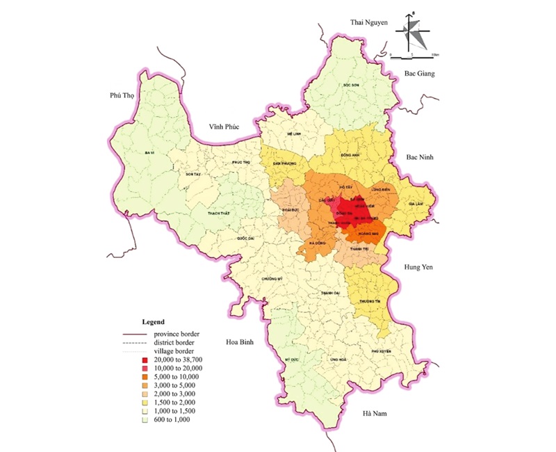
The average population density of Hanoi is approximately 2,511 people per square kilometer. The highest population density is concentrated in central districts such as Hoan Kiem, Ba Dinh, Dong Da and Hai Ba Trung. Meanwhile, suburban districts like Ba Vi and Soc Son have lower population densities, averaging less than 1,000 people per square kilometer.
2. Administrative map of Hanoi
After multiple expansions of its administrative boundaries, Hanoi currently has 30 districts and towns, including 12 urban districts, 17 rural districts and 1 town. These are further divided into 579 administrative units at the commune level, comprising 383 communes, 175 wards and 21 townships. Through the administrative map of Hanoi, residents and organizations can accurately look up detailed information about the administrative units, boundaries of districts, wards, communes and townships within the city.
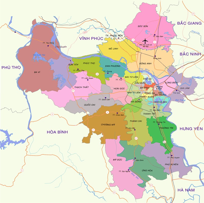
Below is the most recently updated list of Hanoi districts:
| District | Area (km2) | Population 2020 (people) | Number of wards and communes |
| Ba Dinh district | 9,21 | 226.315 | 14 wards |
| Bac Tu Liem District | 45,24 | 354.364 | 13 wards |
| Cau Giay District | 12,44 | 294.235 | 8 wards |
| Dong Da district | 9,95 | 376.709 | 21 wards |
| Ha Dong District | 49,64 | 382.637 | 17 wards |
| Hai Ba Trung District | 10,26 | 304.101 | 18 wards |
| Hoan Kiem District | 5,35 | 141.687 | 18 wards |
| Hoang Mai District | 40,19 | 540.732 | 14 wards |
| Long Bien District | 60,09 | 337.982 | 14 wards |
| Nam Tu Liem District | 32,17 | 282.444 | 10 wards |
| West Lake District | 24,38 | 167.851 | 8 wards |
| Thanh Xuan district | 9,17 | 293.292 | 11 wards |
| Ba Vi district | 421,8 | 305.933 | 1 town, 30 communes |
| Chuong My district | 237,48 | 347.564 | 2 towns, 30 communes |
| Dan Phuong district | 77,83 | 185.653 | 1 town, 15 communes |
| Dong Anh district | 185,68 | 437.308 | 1 town, 23 communes |
| Gia Lam district | 116,64 | 292.943 | 2 towns, 20 communes |
| Hoai Duc district | 84,92 | 257.633 | 1 town, 19 communes |
| Me Linh district | 141,29 | 241.633 | 2 towns, 16 communes |
| My Duc district | 226,31 | 203.778 | 1 town, 21 communes |
| Phu Xuyen district | 173,56 | 229.847 | 2 towns, 25 communes |
| Phuc Tho district | 118,5 | 194.754 | 1 town, 20 communes |
| Quoc Oai district | 151,22 | 203.079 | 1 town, 20 communes |
| Soc Son district | 305,51 | 357.652 | 1 town, 25 communes |
| Thach That district | 187,53 | 223.844 | 1 town, 22 communes |
| Thanh Oai District | 124,47 | 227.541 | 1 town, 20 communes |
| Thanh Tri district | 63,49 | 288.839 | 1 town, 15 communes |
| Thuong Tin | 130,13 | 262.222 | 1 town, 28 communes |
| Ung Hoa district | 188,24 | 212.224 | 1 town, 28 communes |
| Son Tay town | 117,2 | 151.090 | 9 wards, 6 communes |
3. Administrative map of Hanoi districts
Along with various planning directions and expansions of Hanoi’s cadastral map, the city’s districts have undergone significant changes over the past decades. Currently, Hanoi has 30 administrative units at the district level, including 1 town, 12 urban districts and 17 rural districts. The latest updates to the detailed district map of Hanoi are provided below!
3.1. Map of Ba Dinh district
Ba Dinh District is divided into 14 wards, including: Cong Vi, Doi Can, Dien Bien, Giang Vo, Kim Ma, Lieu Giai, Ngoc Khanh, Ngoc Ha, Nguyen Trung Truc, Phuc Xa, Quan Thanh, Thanh Cong, Truc Bach, Vinh Phuc.
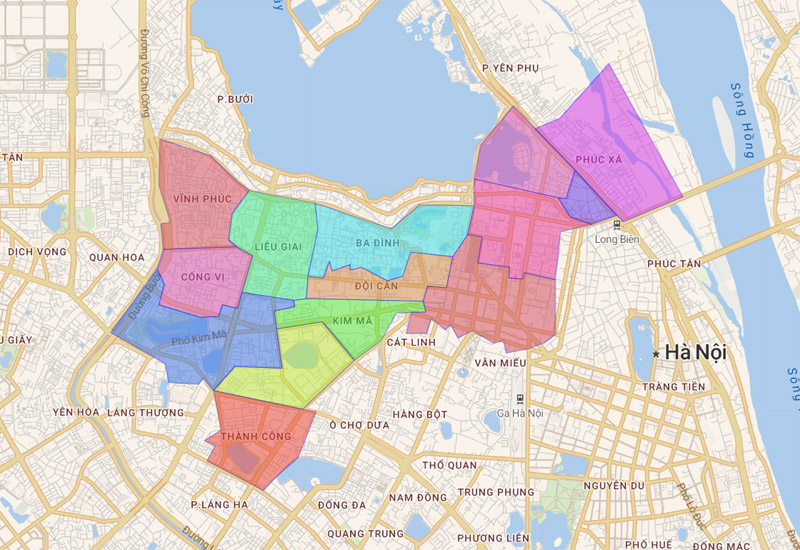
>>> See now: Office buildings for rent in Ba Dinh District
3.2. Map of Hoan Kiem district
18 commune-level administrative units under Hoan Kiem district include: Chuong Duong, Cua Nam, Cua Dong, Dong Xuan, Hang Bo, Hang Bong, Hang Bac, Hang Buom, Hang Bai, Hang Dao, Hang Gai, Hang Ma , Hang Trong, Ly Thai To, Phan Chu Trinh, Phuc Tan, Tran Hung Dao, Trang Tien.
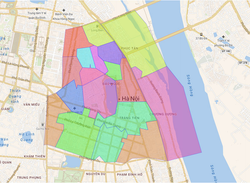
>>> See now: Office buildings for rent in Hoan Kiem District
3.3. Map of Tay Ho district
Tay Ho district currently has 8 affiliated wards, including wards: Buoi, Nhat Tan, Phu Thuong, Thuy Khue, Tu Lien, Quang An, Xuan La, Yen Phu.
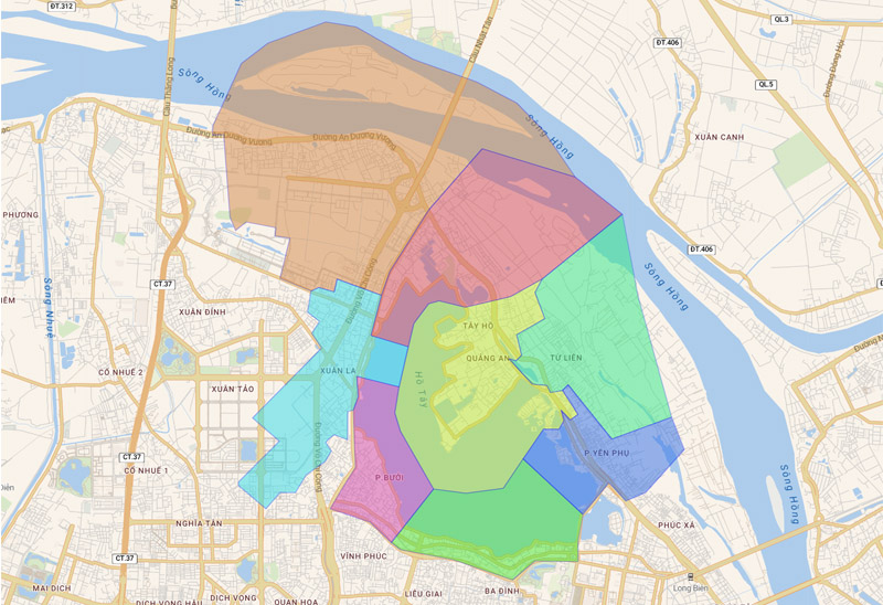
>>> See now: Office buildings for rent in Tay Ho District
3.4. Map of Long Bien district
The administrative unit of Long Bien district currently has 14 wards: Bo De, Cu Khoi, Duc Giang, Gia Thuy, Giang Bien, Long Bien, Ngoc Lam, Ngoc Thuy, Phuc Dong, Phuc Loi, Sai Dong, Thach Ban, Thuong Thanh , Viet Hung.
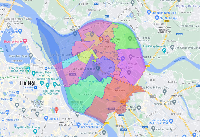
>>> See now: Office buildings for rent in Long Bien District
3.5. Map of Cau Giay district
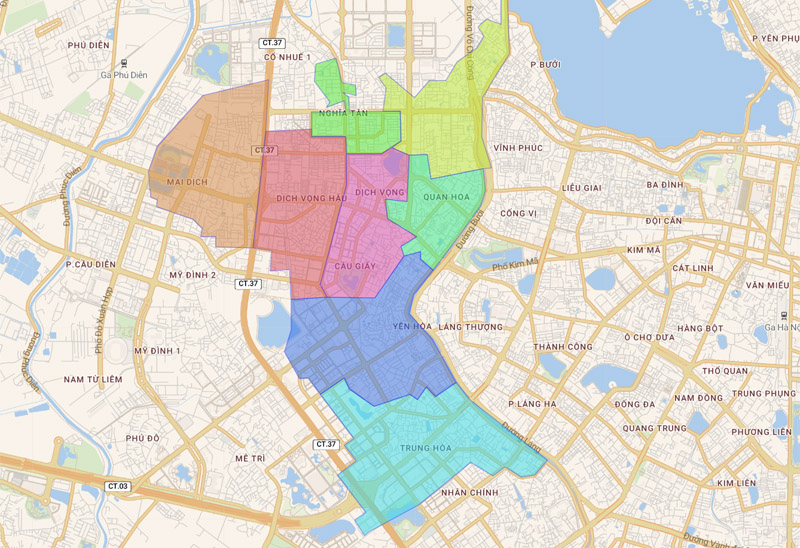
Cau Giay District is divided into 8 commune-level administrative units, including: Dich Vong, Dich Vong Hau, Mai Dich, Nghia Tan, Nghia Do, Quan Hoa, Yen Hoa, Trung Hoa wards.
>>> See now: Office buildings for rent in Cau Giay District
3.6. Map of Dong Da district
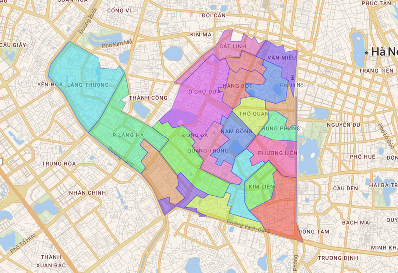
There are currently 21 commune-level administrative units under Dong Da district, including:
| Cat Linh | Nam Dong | Tho Quan |
| Hang Bot | Nga Tu So | Thinh Quang |
| Kham Thien | O Cho Dua | Trung Liet |
| Khuong Thuong | Phuong Mai | Trung Phung |
| Kim Lien | Phuong Lien | Trung Tu |
| Lang Ha | Quang Trung | Van Chuong |
| Lang Thuong | Quoc Tu Giam | Van Mieu |
>>> See now: Office buildings for rent in Dong Da District
3.7. Map of Hai Ba Trung district
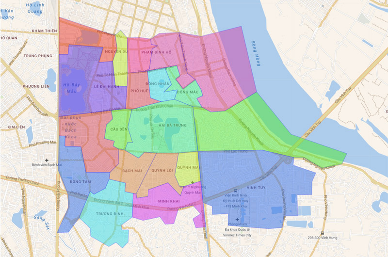
The administrative unit of Hai Ba Trung district is divided into 18 wards, including: Bach Khoa, Bach Mai, Bach Dang, Cau Den, Dong Mac, Dong Tam, Dong Nhan, Le Dai Hanh, Minh Khai, Nguyen Du, Pho Hue , Pham Dinh Ho, Quynh Mai, Quynh Loi, Thanh Nhan, Thanh Luong, Truong Dinh, Vinh Tuy.
>>> See now: Office buildings for rent in Hai Ba Trung District
3.8. Map of Hoang Mai district
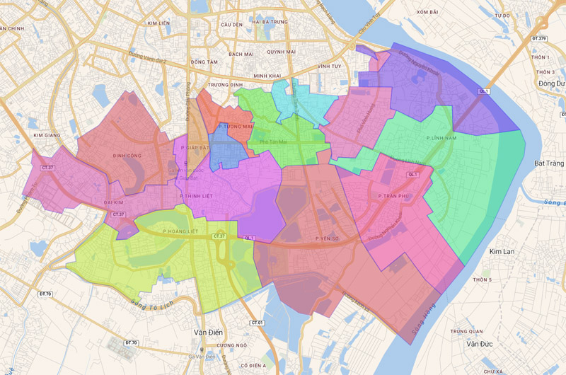
Hoang Mai District, Hanoi is divided into 14 administrative units, including wards: Dai Kim, Giap Bat, Dinh Cong, Hoang Van Thu, Hoang Liet, Linh Nam, Mai Dong, Thinh Liet, Tan Mai, Thanh Tri, Tran Phu, Tuong Mai, Yen So, Vinh Hung.
>>> See now: Office buildings for rent in Hoang Mai District
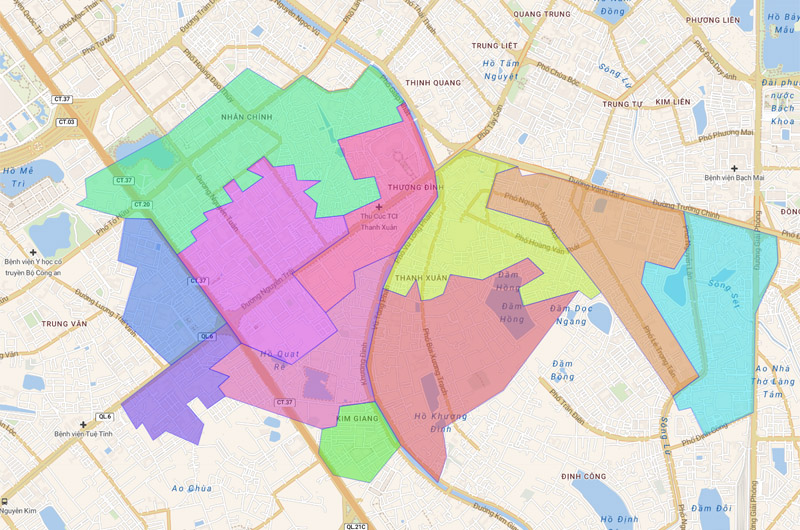
3.9. Map of Thanh Xuan district
The administrative boundaries of Thanh Xuan district include 11 wards: Ha Dinh, Thuong Dinh, Khuong Dinh, Nhan Chinh, Khuong Mai, Phuong Liet, Khuong Trung, Kim Giang, Thanh Xuan Bac, Thanh Xuan Trung, Thanh Xuan Nam.
>>> See now: Office buildings for rent in Thanh Xuan District
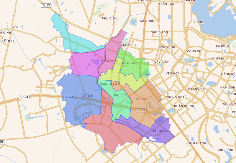
3.10. Map of Nam Tu Liem district
Up to now, Nam Tu Liem district has 10 affiliated wards, including: Cau Dien, Phu Do, Trung Van, Dai Mo, Me Tri, Phuong Canh, My Dinh 1, My Dinh 2, Tay Mo, Xuan Phuong.
>>> See now: Office buildings for rent in Nam Tu Liem District
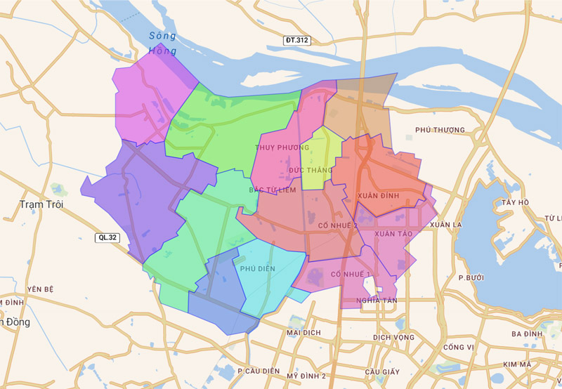
3.11. Map of Bac Tu Liem district
Bac Tu Liem District is divided into 13 wards, including: Dong Ngac, Duc Thang, Co Nhue 1, Co Nhue 2, Minh Khai, Phu Dien, Lien Mac, Thuong Cat, Xuan Dinh, Xuan Tao, Phuc Dien , Thuong Cat, Thuy Phuong.
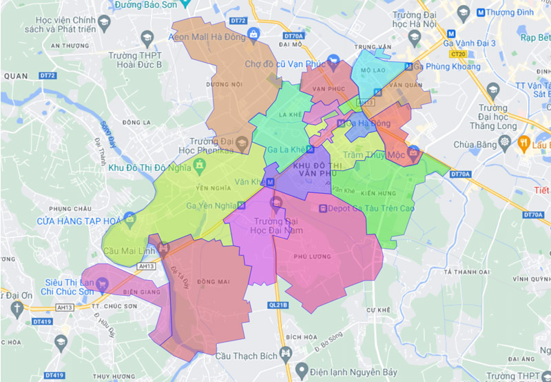
3.12. Map of Ha Dong district
The administrative unit of Ha Dong district is divided into 17 wards: Duong Noi, Ha Cau, Phu Lam, Phu Luong, Dong Mai, Kien Hung, Bien Giang, La Khe, Van Phuc, Van Quan, Yen Nghia, Yet Kieu, Nguyen Trai, Mo Lao, Quang Trung, Phu La, Phuc La.
>>> See now: Office buildings for rent in Ha Dong District
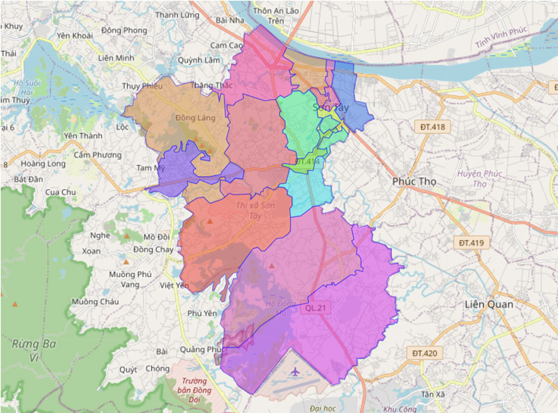
3.13. Map of Son Tay town
Son Tay town is located 45 km west of Hanoi city center, divided into 15 administrative units, including 9 wards and 6 communes. As follows:
- Le Loi Ward
- Ngo Quyen Ward
- Phu Thinh Ward
- Quang Trung ward
- Son Loc Ward
- Trung Hung Ward
- Trung Son Tram Ward
- Vien Son Ward
- Xuan Khanh Ward
- Co Dong Commune
- Duong Lam commune
- Kim Son commune
- Son Dong commune
- Thanh My commune
- Xuan Son commune
3.14. Map of Soc Son district
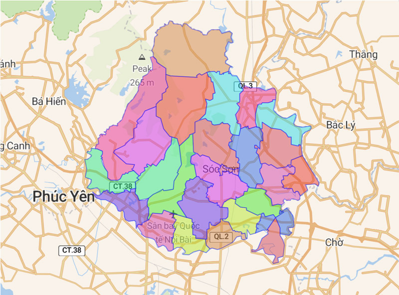
Currently, there are 26 commune-level administrative units under Soc Son district. Which includes: 1 town (Soc Son) and 25 communes: Dong Xuan, Duc Hoa, Mai Dinh, Minh Phu, Bac Phu, Bac Son, Hien Ninh, Hong Ky, Nam Son, Phu Cuong, Kim Lu, Phu Linh, Phu Lo, Tan Dan, Tan Hung, Phu Minh, Xuan Giang, Xuan Thu, Quang Tien, Thanh Xuan, Tien Duoc, Trung Gia, Minh Tri, Viet Long, Tan Minh.
3.15. Map of Dong Anh district
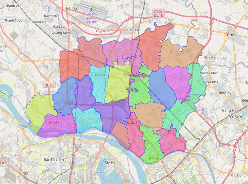
Dong Anh district belongs to the city. Hanoi has 24 official commune-level administrative units. It includes 1 Dong Anh town (district capital) and 23 communes (Bac Hong, Co Loa, Dai Mach, Dong Hoi, Duc Tu, Hai Boi, Kim Chung, Kim No, Lien Ha, Mai Lam, Nam Hong, Nguyen Khe, Tam Xa, Thuy Lam, Tien Duong, Uy No, Van Ha, Van Noi, Viet Hung, Vinh Ngoc, Vong La, Xuan Canh, Xuan Non).
3.16. Map of Gia Lam district
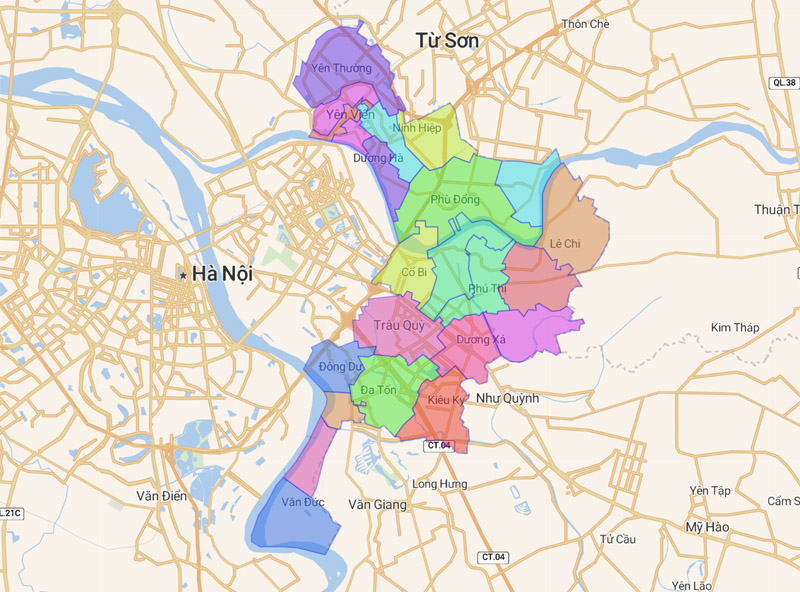
Gia Lam district map currently has 22 administrative units, including 2 towns: Yen Vien and Trau Quy (district capital). In addition, there are 20 communes: Da Ton, Dang Xa, Bat Trang, Phu Thi, Dong Du, Co Bi, Duong Xa, Kieu Ky, Duong Ha, Duong Quang, Kim Lan, Van Duc, Phu Dong, Trung Mau, Le Chi , Ninh Hiep, Dinh Xuyen, Kim Son, Yen Thuong, Yen Vien.
3.17. Map of Thanh Tri district
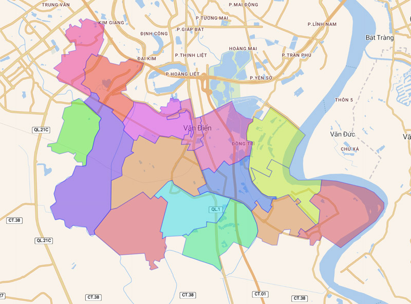
Thanh Tri district includes 16 commune-level administrative units, including 1 town (Van Dien) and 15 communes: Dai Ang, Dong My, Duyen Ha, Huu Hoa, Lien Ninh, Ngoc Hoi, Ngu Hiep, Ta Thanh Oai , Tam Hiep, Tan Trieu, Thanh Liet, Tu Hiep, Van Phuc, Vinh Quynh, Yen My.
3.18. Map of Me Linh district
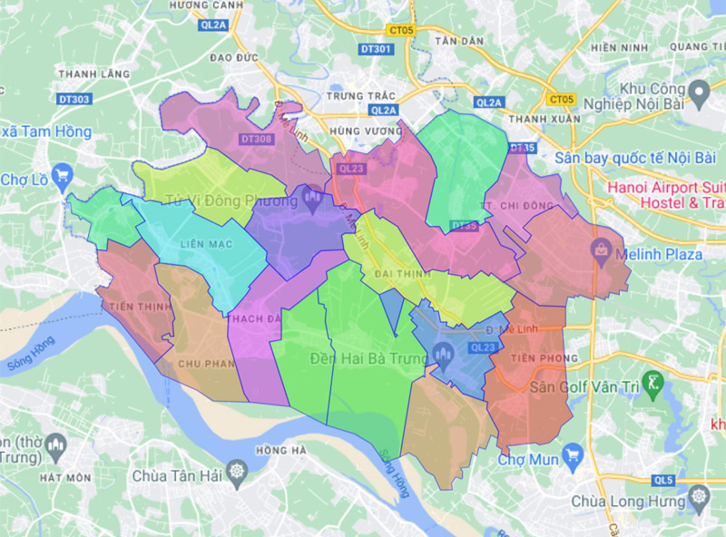
There are currently 18 commune-level administrative units under Me Linh district. It includes 2 towns: Chi Dong, Quang Minh and 16 communes: Chu Phan, Tien Phong, Tien Thang, Dai Thinh (district capital), Me Linh, Lien Mac, Trang Viet, Tu Lap, Tam Dong, Thach Da , Thanh Lam, Tien Thinh, Van Khe, Hoang Kim, Kim Hoa, Van Yen.
3.19. Map of Ba Vi district
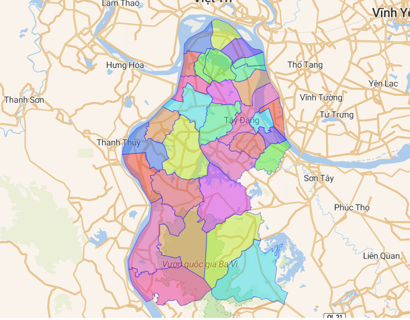
Ba Vi district is divided into 31 commune-level administrative units, including Tay Dang town and 30 communes listed in the table as follows:
| Ba Trai | Minh Chau | Tan Linh |
| Ba Vi | Minh Quang | Thai Hoa |
| Cam Linh | Phong Van | Thuan My |
| Cam Thuong | Phu Chau | Thuy An |
| Chau Son | Phu Cuong | Tien Phong |
| Chu Minh | Phu Dong | Tong Bat |
| Co Do | Phu Phuong | Van Hoa |
| Dong Quang | Phu Son | Van Thang |
| Dong Thai | Son Da | Vat Lai |
| Khanh Thuong | Tan Hong | Yen Bai |
3.20. Map of Phuc Tho district
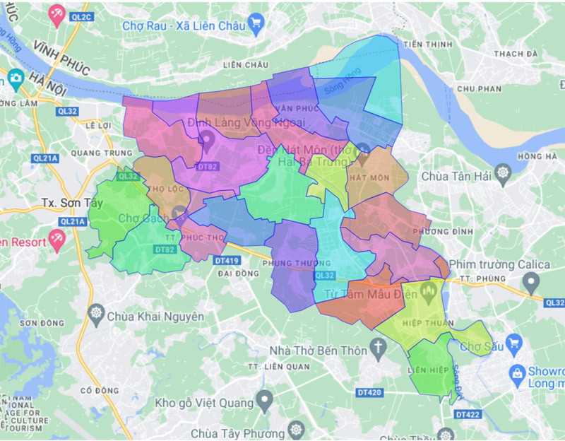
Phuc Tho district (Hanoi) has 21 commune-level administrative units, including Phuc Tho town (district capital) and 20 communes: Hat Mon, Hiep Thuan, Lien Hiep, Long Xuyen, Ngoc Tao, Phuc Hoa, Phung Thuong , Sen Phuong, Tam Hiep, Tam Thuan, Thanh Da, Tho Loc, Thuong Coc, Tich Giang, Trach My Loc, Van Ha, Van Nam, Van Phuc, Vong Xuyen, Xuan Dinh.
3.21. Map of Dan Phuong district
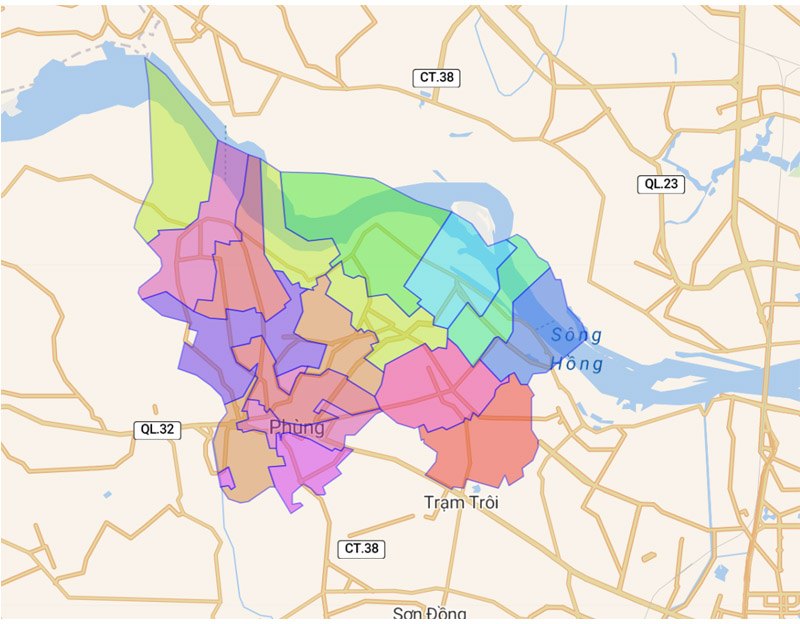
On the map of Hanoi, Dan Phuong district includes: 1 Phung town and 15 communes: Dan Phuong, Dong Thap, Ha Mo, Hong Ha, Lien Ha, Lien Hong, Lien Trung, Phuong Dinh, Song Phuong, Tan Hoi, Tan Lap, Tho An, Tho Xuan, Thuong Mo, Trung Chau.
3.22. Map of Hoai Duc district
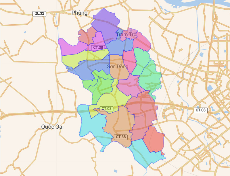
Hoai Duc district, Hanoi is divided into 20 commune-level administrative units. It includes 1 town (Tram Troi) and 19 communes: An Khanh, An Thuong, Cat Que, Dac So, Di Trach, Dong La, Duc Giang, Duc Thuong, Duong Lieu, Kim Chung, La Phu, Lai Yen , Minh Khai, Son Dong, Song Phuong, Tien Yen, Van Canh, Van Con, Yen So.
3.23. Map of Quoc Oai district
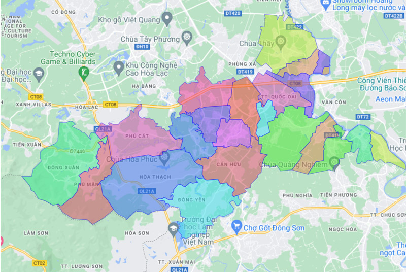
Quoc Oai district includes 21 commune-level administrative units. Including 1 town (Quoc Oai) and 20 communes: Can Huu, Cong Hoa, Dai Thanh, Dong Quang, Dong Yen, Hoa Thach, Liep Tuyet, Nghia Huong, Ngoc Liep, Ngoc My, Phu Cat, Phu Man, Phuong Cach, Sai Son, Tan Hoa, Tan Phu, Thach Than, Tuyet Nghia, Yen Son, Dong Xuan.
3.24. Map of Thach That district
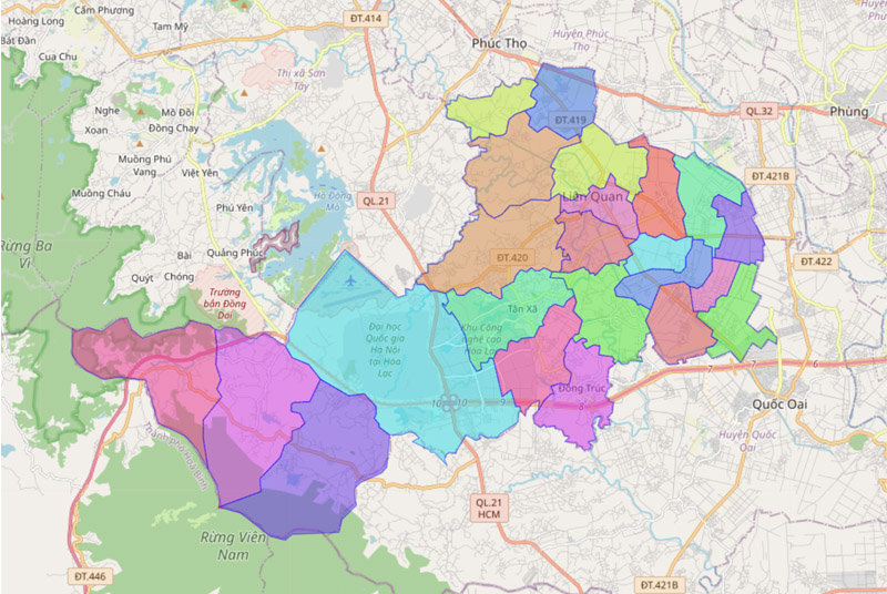
Thach That district administrative unit includes: 1 town (Lien Quan) and 22 communes: Binh Phu, Binh Yen, Cam Yen, Can Kiem, Canh Nau, Chang Son, Dai Dong, Di Nau, Dong Truc, Ha Bang , Huong Ngai, Huu Bang, Kim Quan, Lai Thuong, Phu Kim, Phung Xa, Tan Xa, Thach Hoa, Thach Xa, Tien Xuan, Yen Binh, Yen Trung.
3.25. Map of Chuong My district
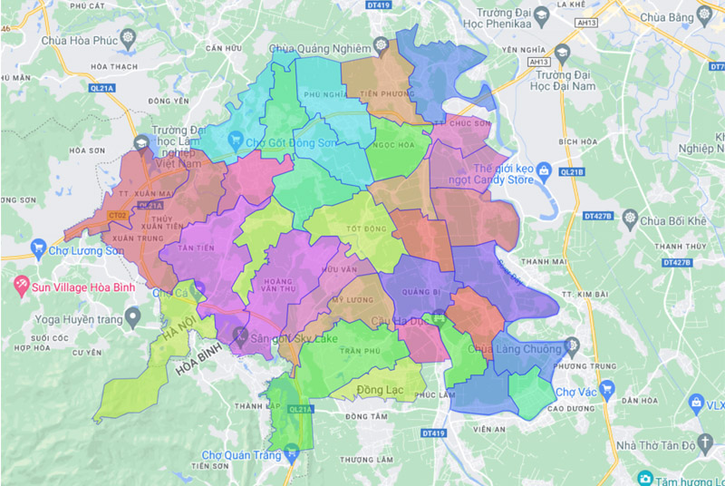
Chuong My district is divided into 32 administrative units, including 2 towns (Chuc Son, Xuan Mai) and 30 communes: Dai Yen, Dong Phuong Yen, Dong Son, Dong Lac, Dong Phu, Hoa Chinh, Hoang Dieu, Hoang Van Thu, Hong Phong, Hop Dong, Huu Van, Lam Dien, My Luong, Nam Phuong Tien, Ngoc Hoa, Phu Nam An, Phu Nghia, Phung Chau, Quang Be, Tan Tien, Tien Phuong, Tot Dong, Thanh Binh , Thuy Xuan Tien, Thuy Huong, Thuong Vuc, Tran Phu, Trung Hoa, Truong Yen, Van Vo.
3.26. Map of Thanh Oai district
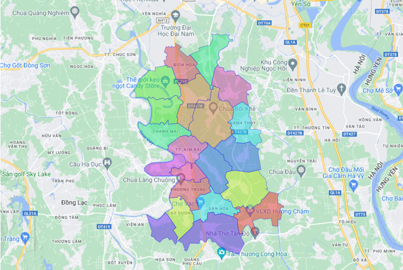
On the administrative map of Hanoi, Thanh Oai district has 21 administrative units. It includes 1 town (Kim Bai) and 20 communes: Bich Hoa, Binh Minh, Cao Duong, Cao Vien, Cu Khe, Dan Hoa, Do Dong, Hong Duong, Kim An, Kim Thu, Lien Chau, My Hung, Phuong Trung, Tam Hung, Tan Uoc, Thanh Cao, Thanh Mai, Thanh Thuy, Thanh Van, Xuan Duong.
3.27. Map of Thuong Tin district
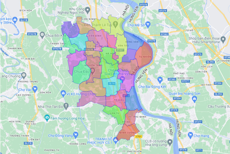
Thuong Tin district belongs to the city. Hanoi is divided into 29 commune-level administrative units. It includes 1 town (Thuong Tin) and 28 communes: Chuong Duong, Dung Tien, Duyen Thai, Ha Hoi, Hien Giang, Hoa Binh, Khanh Ha, Hong Van, Le Loi, Lien Phuong, Minh Cuong, Nghiem Xuyen, Nguyen Trai, Nhi Khe, Ninh So, Quat Dong, Tan Minh, Thang Loi, Thong Nhat, Thu Phu, Tien Phong, To Hieu, Tu Nhien, Van Diem, Van Binh, Van Phu, Van Tu, Van Tao.
3.28. Map of Phu Xuyen district
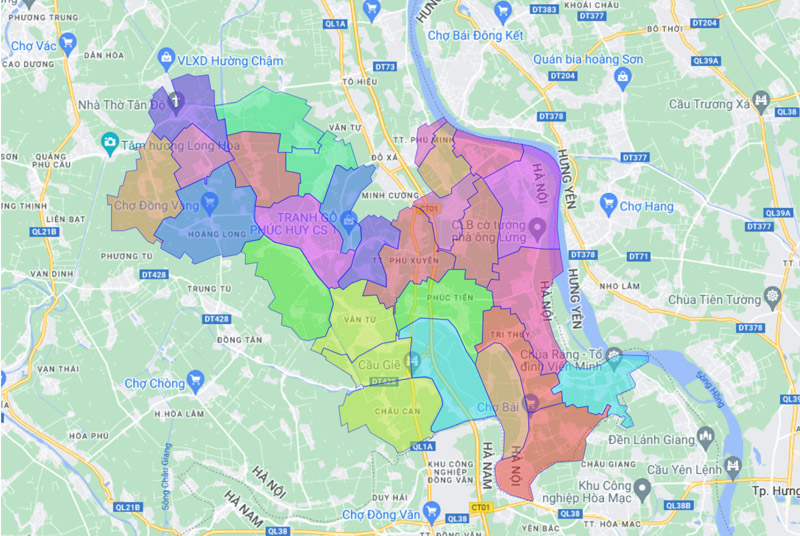
The administrative unit of Phu Xuyen district includes: 2 towns (Phu Xuyen, Phu Minh) and 25 communes: Bach Ha, Chau Can, Chuyen My, Dai Thang, Dai Xuyen, Hoang Long, Hong Minh, Hong Thai, Khai Thai, Minh Tan, Nam Phong, Nam Tien, Nam Trieu, Phu Tuc, Phu Yen, Phuc Tien, Phuong Duc, Quang Lang, Quang Trung, Son Ha, Tan Dan, Tri Thuy, Tri Trung, Van Hoang, Van Tu.
3.29. Map of Ung Hoa district
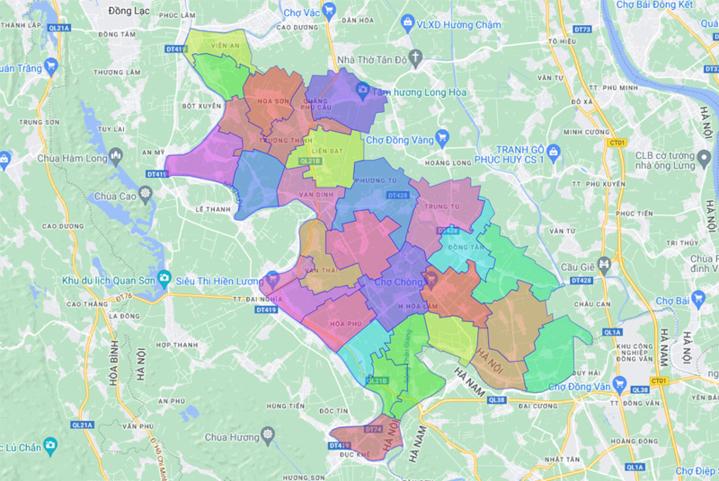
Ung Hoa district is divided into 29 administrative units, including: 1 town (Van Dinh) and 28 communes: Cao Thanh, Dai Cuong, Dai Hung, Doi Binh, Dong Lo, Dong Tien, Dong Tan, Hoa Son , Hoa Lam, Hoa Nam, Hoa Phu, Hoa Xa, Hong Quang, Kim Duong, Lien Bat, Luu Hoang, Minh Duc, Phu Luu, Phuong Tu, Quang Phu Cau, Son Cong, Tao Duong Van, Tram Long, Trung Tu , Truong Thinh, Van Thai, Vien An, Vien Noi.
3.30. Map of My Duc district
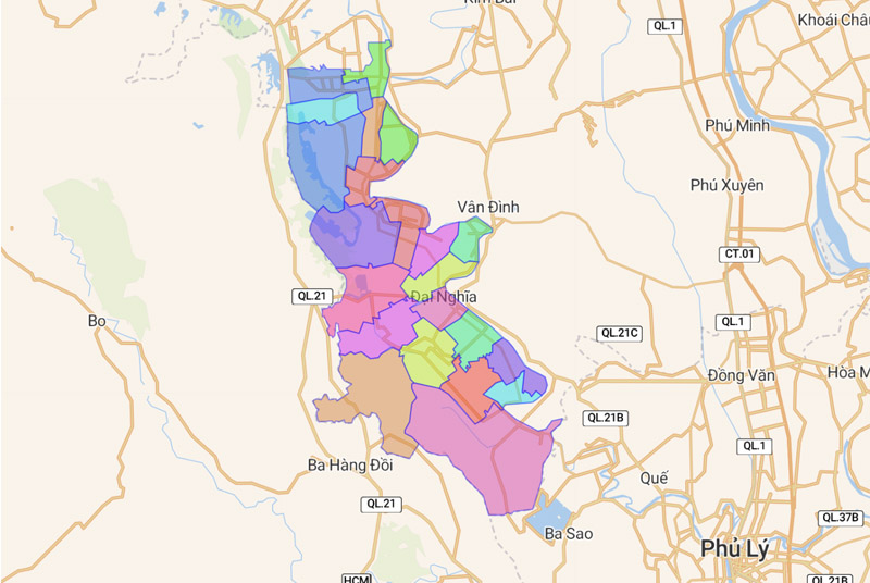
The administrative unit of My Duc district includes: 1 town (Dai Nghia) and 21 communes: An My, An Phu, An Tien, Bot Xuyen, Dai Hung, Doc Tin, Dong Tam, Hong Son, Hop Thanh, Hop Tien , Hung Tien, Huong Son, Le Thanh, My Thanh, Phu Luu Te, Phuc Lam, Phung Xa, Thuong Lam, Tuy Lai, Van Kim, Xuy Xa.
4. Map of Office Buildings in Hanoi
As the capital of Vietnam and an important economic and administrative center, the office rental market in Hanoi is highly developed. Currently, Hanoi has over 600 office buildings available for lease, categorized into Class A, B and C.
In conclusion, the map of Hanoi is an extremely useful tool, providing not only information about administrative units but also reflecting the rapid changes the city has undergone over the years. We hope this article has given you a broader perspective on Hanoi—the pride of every Vietnamese citizen!


