Map of Northern Vietnam Provinces: Detailed List and Overview
Vietnam is a beautiful country with a coastline stretching from North to South and many stunning landscapes. Each region of Vietnam has its own unique characteristics in terms of geography, climate and people. Among them, Northern Vietnam is considered the “cradle” of the country’s history and culture, but not everyone knows how many provinces and municipalities are in the North. To help you answer this question, Maison Office has compiled below a list of provinces in Northern Vietnam and the latest updated map of the region!
Table of Contents
- 1. How many provinces and cities are there in the North?
- 2. List of the latest updated provinces in Northern Vietnam
- 3. Detailed map of Northern provinces and cities
- Map of Son La Province
- Map of Lai Chau province
- Map of Hoa Binh province
- Map of Dien Bien province
- Map of Lao Cai province
- Map of Ha Giang province
- Map of Cao Bang province
- Map of Quang Ninh province
- Map of Lang Son province
- Map of Bac Kan province
- Map of Bac Ninh province
- Map of Hai Duong province
- Map of Hanoi capital
- Map of Ha Nam province
- Map of Thai Nguyen province
- Map of Hung Yen province
- Map of Ninh Binh province
- Map of Vinh Phuc province
- Map of Nam Dinh province
- Map of Thai Binh province
- Map of Yen Bai province
- Map of Phu Tho province
- Map of Tuyen Quang province
- Map of Bac Giang province
- Map of Hai Phong city
1. How many provinces and cities are there in the North?
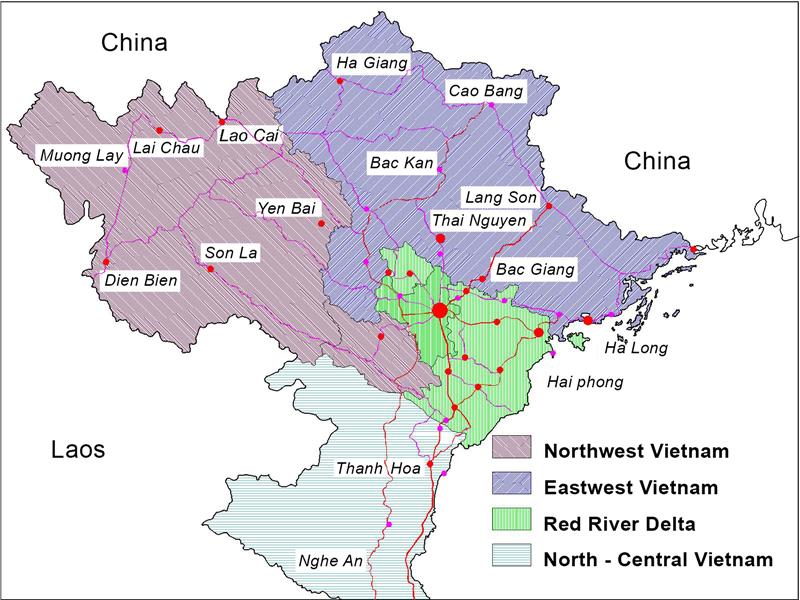
Currently, Northern Vietnam consists of 25 provinces and cities, divided into 3 subregions:
– Northeast Region: Includes 9 provinces: Ha Giang, Cao Bang, Bac Kan, Lang Son, Tuyen Quang, Thai Nguyen, Phu Tho, Bac Giang and Quang Ninh.
– Northwest Region: Includes 6 provinces: Lao Cai, Lai Chau, Yen Bai, Dien Bien, Son La and Hoa Binh.
– Red River Delta: Includes 10 provinces and cities: Hanoi, Ha Nam, Bac Ninh, Hai Duong, Hai Phong, Hung Yen, Nam Dinh, Ninh Binh, Thai Binh and Vinh Phuc.
According to the regional economic planning, the North is divided into 2 socio-economic regions:
– Northern Coastal Region: Includes 11 provinces and cities: Hanoi, Ha Nam, Hai Phong, Hai Duong, Bac Ninh, Quang Ninh, Ninh Binh, Nam Dinh, Hung Yen, Vinh Phuc and Thai Binh.
– Midland and Northern Mountainous Region: Includes 14 provinces: Lao Cai, Lai Chau, Cao Bang, Bac Kan, Hoa Binh, Yen Bai, Thai Nguyen, Dien Bien, Lang Son, Son La, Bac Giang, Tuyen Quang, Ha Giang and Phu Tho, along with 21 districts and 1 town in the western areas of the two provinces of Nghe An and Thanh Hoa.
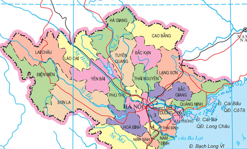
The North is also known by various names such as Bac Bo, Bac Trieu, Bac Ha, Bac Thanh and Dang Ngoai throughout different historical periods and dynasties. This region is located in the extreme north of Vietnam’s territory, sharing borders as follows:
– To the East, it borders the East Sea
– To the West, it borders Laos
– To the North, it borders China
The northern region spans a width of up to 600 km from East to West, making it the largest in comparison to the central and southern regions. The topography of the northern provinces is relatively complex and diverse, featuring a variety of landscapes including hills, plains, coastlines and continental shelves. The surface terrain gradually slopes down from the Northwest to the Southeast, following the flow of major rivers.
2. List of the latest updated provinces in Northern Vietnam
Northern Vietnam is a vast geographical region with strategic importance for the entire country. In terms of natural geography, the provinces in the North are divided into three smaller territories, which include: the Northwest, the Northeast and the Red River Delta. Each area has its own distinct characteristics in terms of geography, administration, climate, natural resources and more.
2.1. List of provinces in the Northwest region
The Northwest region comprises 6 provinces located along the upper reaches of the Red River, including: Lao Cai, Yen Bai, Dien Bien, Lai Chau, Son La and Hoa Binh.
List of 6 Northwestern provinces
| Number | Province | Administrative code | Area (km2) | Population (people) | Population density (people/km2) |
| 1 | Son La | 210 | 14.109,83 | 1.300.100 | 91 |
| 2 | Dien Bien | 11 | 9.539,93 | 635.921 | 66 |
| 3 | Lai Chau | 12 | 9.068,73 | 482.000 | 53 |
| 4 | Yen Bai | 15 | 6.892,67 | 847.200 | 122 |
| 5 | Lao Cai | 10 | 6.364,25 | 770.600 | 121 |
| 6 | Hoa Binh | 17 | 4.590,3 | 877.560 | 190 |
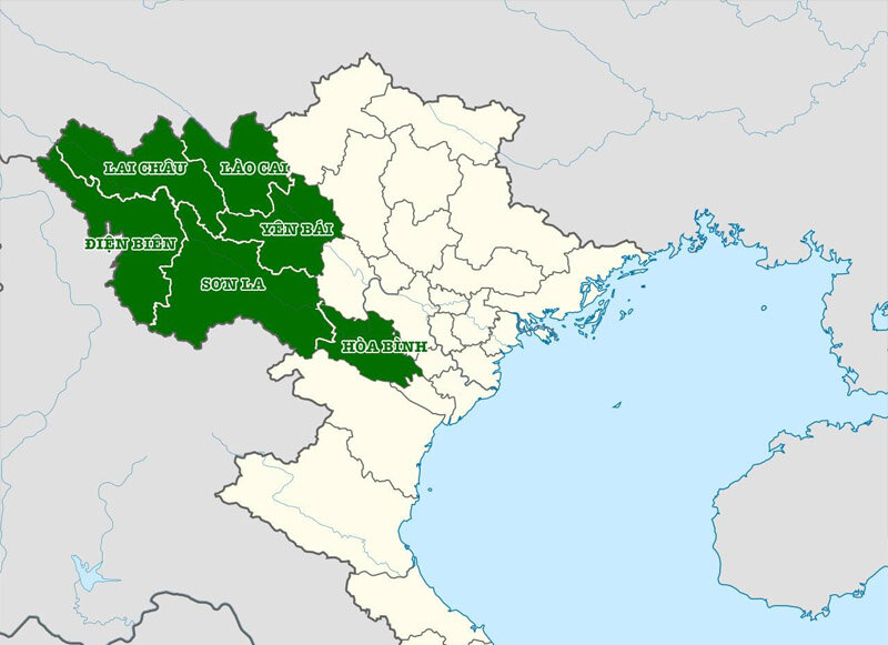
Covering an area of 50,576 square kilometers, the Northwest region is known as the largest territorial area in Vietnam. It boasts extensive forested areas and diverse land, favorable for forestry development. Moreover, the region is rich in mineral resources such as copper, zinc, lead, rare earth minerals, etc., facilitating the development of mining and mineral processing industries. The tourism sector in the Northwest region is also gradually thriving due to its spectacular natural landscapes, diverse ecosystems and cool climate throughout the year.
2.2. List of Northeastern provinces
The Northeast region has 9 provinces and cities including: Cao Bang, Thai Nguyen, Ha Giang, Bac Giang, Quang Ninh, Bac Kan, Phu Tho, Tuyen Quang, Lang Son.
List of 9 Northeastern provinces
| Number | Province | Administrative code | Area (km2) | Population (people) | Population density (people/km2) |
| 1 | Quang Ninh | 22 | 6.120,79 | 1.398.732 | 250 |
| 2 | Bac Kan | 06 | 4.859,96 | 323.712 | 67 |
| 3 | Ha Giang | 02 | 7.927,55 | 892.700 | 113 |
| 4 | Phu Tho | 25 | 3.534,56 | 1.516.900 | 429 |
| 5 | Bac Giang | 24 | 3.895,89 | 1.890.92 | 481 |
| 6 | Tuyen Quang | 08 | 5.867,95 | 805.800 | 137 |
| 7 | Lang Son | 20 | 9.310,18 | 802.100 | 96 |
| 8 | Cao Bang | 04 | 6.700,39 | 543.100 | 81 |
| 9 | Bac Giang | 24 | 3.895,89 | 1.890.925 | 481 |
Northeast is a territory in the northeast of the North, with mainly low mountainous terrain and surrounded by many archipelagos, large and small islands. This area is limited to the East and North by the Vietnam-China border; Southeast facing the Gulf of Tonkin; The south is limited by the Tam Dao mountain range and the Red River Delta.
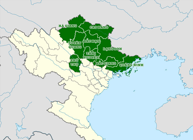
With an area of 50,576 square kilometers, the Northwest is known as the region with the largest territory in Vietnam. It features vast forested areas and diverse land, which are conducive to forestry development. Additionally, this region is rich in various minerals such as copper, zinc, lead and rare earth elements, facilitating the development of mining and mineral processing industries. The tourism sector in the Northwest is also gradually thriving, thanks to its majestic natural landscapes, beautiful ecosystems and mild climate year-round.
2.3. Red River Delta area
The Red River Delta region is divided into 10 provinces and cities, including 8 provinces: Bac Ninh, Hai Duong, Nam Dinh, Ha Nam, Thai Binh, Ninh Binh, Hung Yen, Vinh Phuc and 2 centrally run cities. are Hanoi and Hai Phong.
List of 8 provinces in the Red River Delta region
| Number | Province | Administrative code | Area (km2) | Population (people) | Population density (people/km2) |
| 1 | Bac Ninh | 27 | 822,71 | 1.488.250 | 1.809 |
| 2 | Ha Nam | 35 | 861,93 | 978.100 | 1.135 |
| 3 | Ha Noi | 01 | 3.359,82 | 8.436.700 | 2.511 |
| 4 | Hai Duong | 30 | 1.668,28 | 1.946.800 | 1.167 |
| 5 | Hung Yen | 33 | 930,20 | 1.302.000 | 1400 |
| 6 | Hai Phong | 31 | 1.526,52 | 2.088.000 | 1368 |
| 7 | Nam Dinh | 36 | 1.668,83 | 1.876.900 | 1.125 |
| 8 | Ninh Binh | 37 | 1.411,78 | 1.010.700 | 716 |
| 9 | Thai Binh | 34 | 1.584,61 | 1.878.500 | 1185 |
| 10 | Vinh Phuc | 26 | 1236 | 1.204.300 | 969 |
The Red River Delta (or Northern Delta) is a territory located in the lower reaches of the Red River and Thai Binh River. The terrain of this region is primarily characterized by large, flat plains, with a maximum elevation of 1.2 meters above sea level. The landscape gradually slopes downward from the Northwest to the Southeast. The geographical location of the Red River Delta on the map is as follows:
– To the East and Southeast, it faces the Gulf of Tonkin.
– To the West and Northwest, it borders the Northwest region.
– To the Southwest, it borders the North Central region.
– To the North and Northeast, it borders the Northeast region.
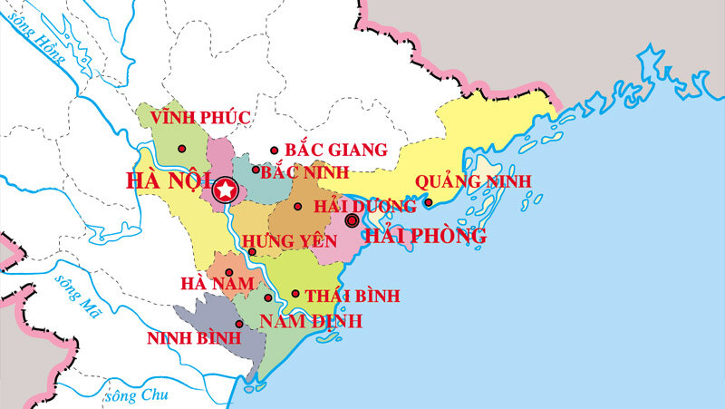
This region is known to have the highest population density in Vietnam. As of 2021, the population of the Red River Delta was 21,848,913 people, accounting for approximately 22.3% of the total population of the country. The population density reached 1,450 people/km², with the majority being ethnic Kinh.
3. Detailed map of Northern provinces and cities
Thus, we have explored the provinces that currently make up the northern region. To provide you with a detailed perspective on the northern area of Vietnam, Maison Office has compiled the map of northern provinces and detailed administrative information for each region below:
Map of Son La Province
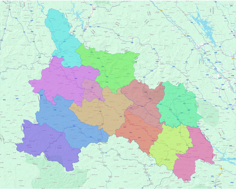
Son La is a province in the Northern region with 12 administrative units, including Son La City and 11 districts: Ma River, Muong La, Moc Chau, Quynh Nhai, Bac Yen, Van Ho, Mai Son, Thuan Chau, Sop Cop, Phu Yen and Yen Chau.
Map of Lai Chau province
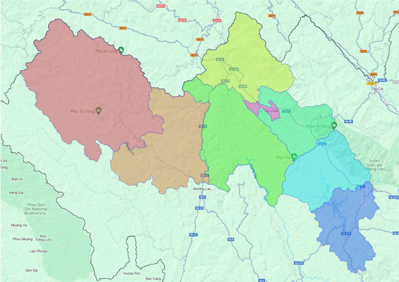
Lai Chau province is divided into 8 district-level administrative units, including Lai Chau city and 7 districts: Nam Nhun, Sin Ho, Than Uyen, Muong Te, Tan Uyen, Phong Tho, Tam Duong.
Map of Hoa Binh province
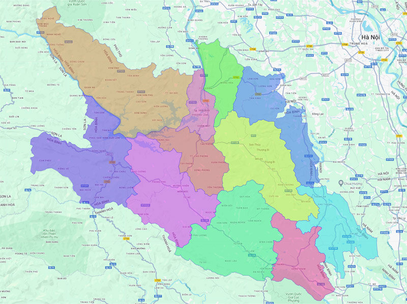
The administrative unit of Hoa Binh province currently includes Hoa Binh city and 9 districts: Kim Boi, Mai Chau, Da Bac, Lac Son, Lac Thuy, Yen Thuy, Luong Son, Cao Phong, Tan Lac.
Map of Dien Bien province
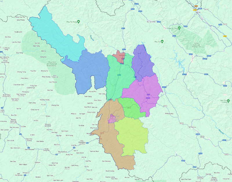
Dien Bien province is currently divided into 10 district-level administrative units. These include: Dien Bien Phu city, Muong Lay town and 8 districts: Muong Nhe, Dien Bien, Dien Bien Dong, Muong Cha, Tua Chua, Muong Ang, Nam Po, Tuan Giao.
Map of Lao Cai province
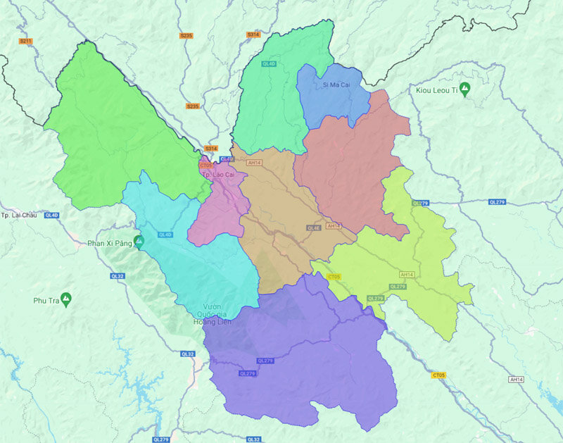
Lao Cai is a province in Northern Vietnam, with 9 district-level administrative units under it. These include: Lao Cai city, Sa Pa town and 7 districts: Van Ban, Muong Khuong, Bao Yen, Bao Thang, Si Ma Cai, Bac Ha, Bat Xat.
Map of Ha Giang province
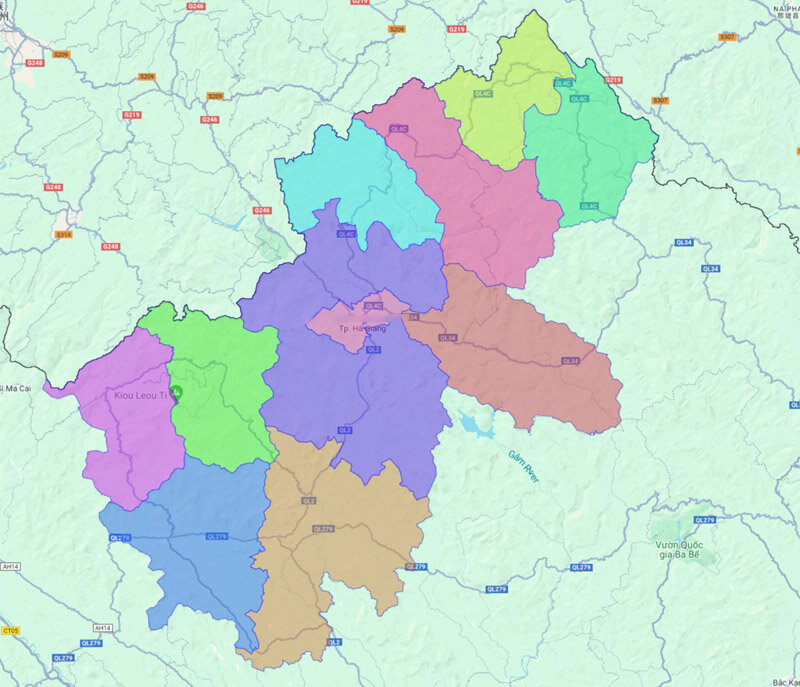
Ha Giang map is currently divided into 11 district-level administrative units. This includes 1 Ha Giang city and 10 districts: Yen Minh, Vi Xuyen, Hoang Su Phi, Xin Man, Bac Quang, Meo Vac, Bac Me, Quan Ba, Dong Van, Quang Binh.
Map of Cao Bang province
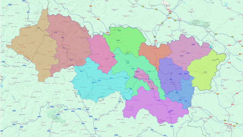
The administrative unit of Cao Bang province currently includes Cao Bang city and 9 districts: Bao Lac, Nguyen Binh, Quang Hoa, Thach An, Ha Quang, Bao Lam, Trung Khanh, Ha Lang, Hoa An.
Map of Quang Ninh province
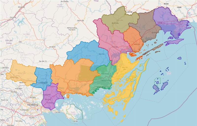
Quang Ninh province currently has 13 district-level administrative units under it. Which includes 4 cities: Ha Long, Mong Cai, Cam Pha, Uong Bi; 2 towns: Dong Trieu, Quang Yen and 7 districts: Binh Lieu, Dam Ha, Ba Che, Co To, Tien Yen, Van Don, Hai Ha.
Map of Lang Son province
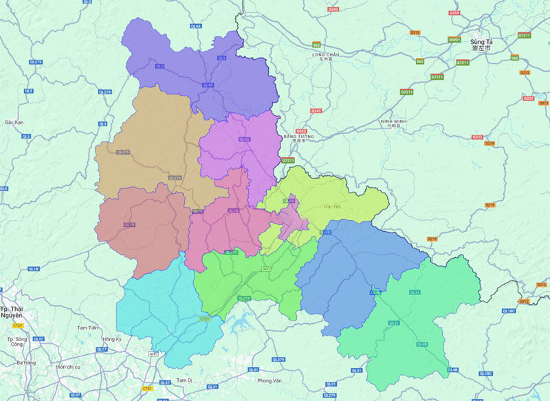
Administrative map of Lang Son province has 11 district-level administrative units. These include 10 districts: Dinh Lap, Loc Binh, Cao Loc, Chi Lang, Van Quang, Bac Son, Huu Lung, Van Lang, Binh Gia, Trang Dinh and Lang Son city.
Map of Bac Kan province
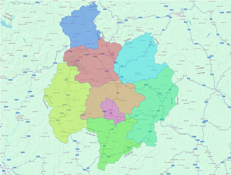
The administrative unit of Bac Kan province currently includes Bac Kan city and 7 districts: Cho Moi, Pac Nam, Cho Don, Bach Thong, Ngan Son, Na Ri, Ba Be.
Map of Bac Ninh province
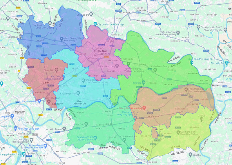
Bac Ninh is currently divided into 8 district-level administrative units. Which includes 2 cities: Bac Ninh, Tu Son; 2 towns: Que Vo, Thuan Thanh and 4 districts: Yen Phong, Gia Binh, Tien Du, Luong Tai.
Map of Hai Duong province
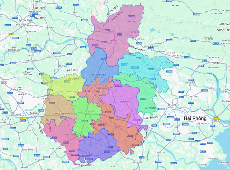
Hai Duong province is currently divided into 12 district-level administrative units. Specifically, including 2 cities: Hai Duong and Chi Linh; 1 Kinh Mon town and 9 districts: Binh Giang, Thanh Ha, Thanh Mien, Nam Sach, Ninh Giang, Gia Loc, Kim Thanh, Cam Giang, Tu Ky.
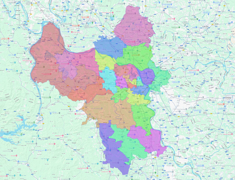
Map of Hanoi capital
The capital Hanoi leads the Northern provinces in the number of affiliated administrative units. Accordingly, Hanoi currently has:
- 12 districts: Ba Dinh, Tay Ho, Cau Giay, Bac Tu Liem, Dong Da, Hoan Kiem, Ha Dong, Hai Ba Trung, Nam Tu Liem, Long Bien, Hoang Mai, Thanh Xuan;
- 17 districts: Ba Vi, Phu Xuyen, Chuong My, Dan Phuong, Dong Anh, Quoc Oai, Soc Son, Gia Lam, Hoai Duc, Thuong Tin, Me Linh, Phuc Tho, Thach Nhat, Thanh Oai, Thanh Tri, My Duc , Ung Hoa.
- 1 town: Son Tay town.
Map of Hanoi capital
Map of Ha Nam province
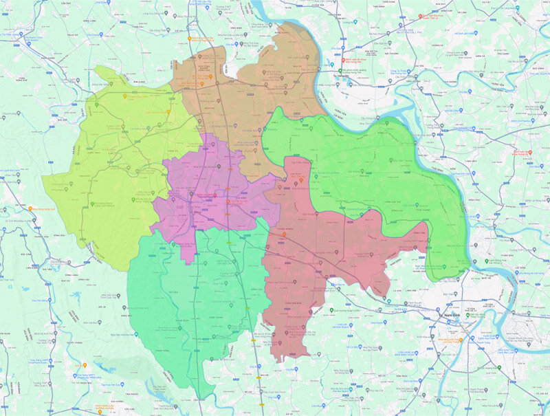
The map of Ha Nam province is divided into 6 district-level administrative units. This includes: Phu Ly City, Duy Tien Town and 4 districts: Ly Nhan, Binh Luc, Thanh Liem, Kim Bang.
Map of Thai Nguyen province
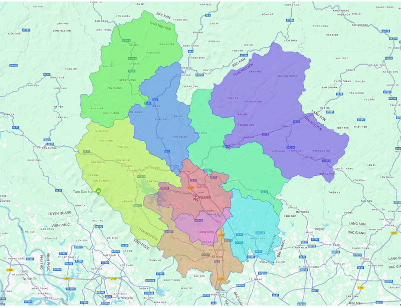
Thai Nguyen province is an administrative unit of Northern Vietnam, including 9 district-level administrative units. Including 3 cities: Thai Nguyen, Pho Yen, Song Cong and 6 districts: Phu Luong, Dinh Hoa, Dai Tu, Phu Binh, Dong Hy, Vo Nhai.
Map of Hung Yen province
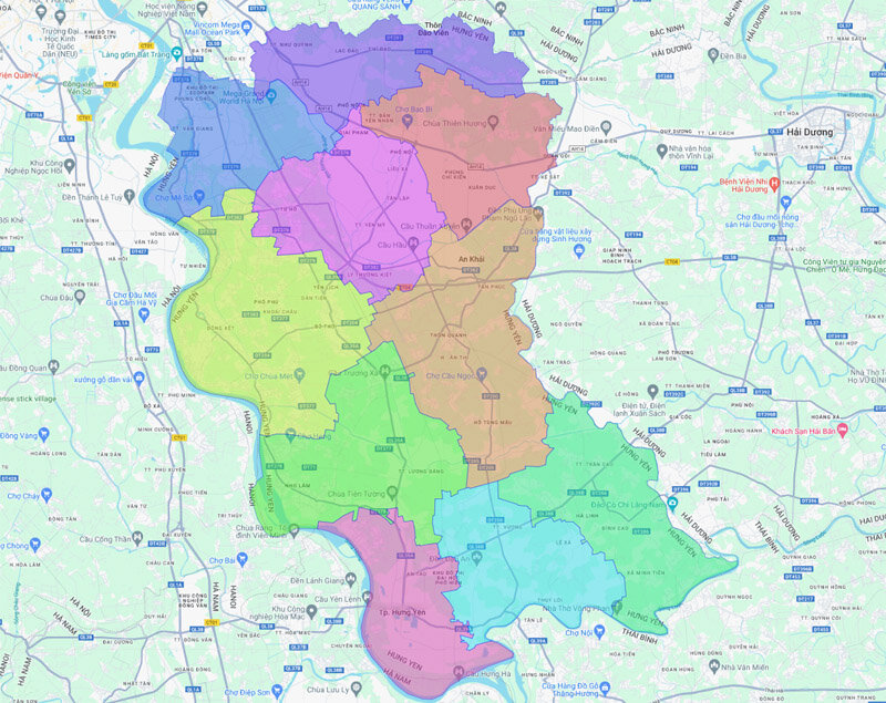
Hung Yen province is divided into 10 district-level administrative units, including: Hung Yen city, My Hao town and 8 districts: Phu Cu, Khoai Chau, Yen My, Tien Lu, An Thi, Kim Dong, Van Giang, Van Lam.
Map of Ninh Binh province
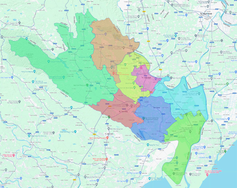
Ninh Binh currently has 8 district-level administrative units under it. It includes 6 districts: Kim Son, Hoa Lu, Yen Mo, Yen Khanh, Gia Vien, Nho Quan and 2 cities: Tam Hiep, Ninh Binh.
Map of Vinh Phuc province
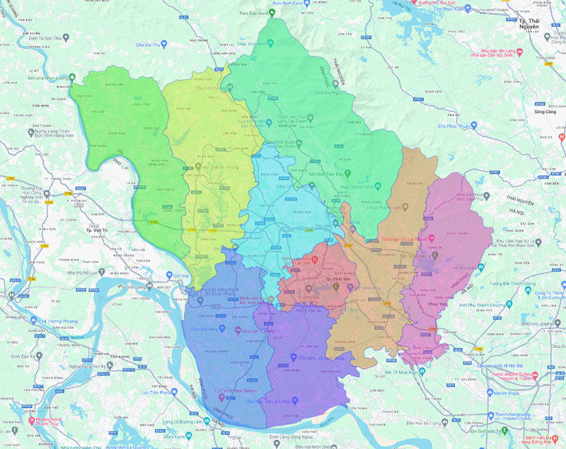
Vinh Phuc province includes 9 district-level administrative units, including 2 cities: Vinh Yen, Phuc Yen and 7 districts: Vinh Tuong, Lap Thach, Yen Lac, Song Lo, Tam Duong, Binh Xuyen, Tam Dao.
Map of Nam Dinh province
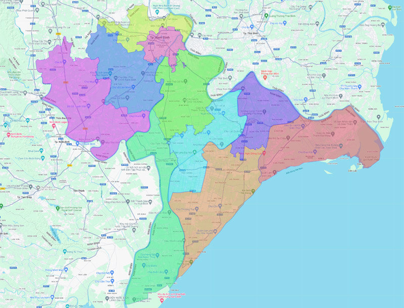
Nam Dinh province currently includes 10 district-level administrative units. Including Nam Dinh city and 9 districts: Nghia Hung, Xuan Truong, Giao Thuy, Truc Ninh, My Loc, Nam Truc, Vu Ban, Hai Hau, Y Yen.
Map of Thai Binh province
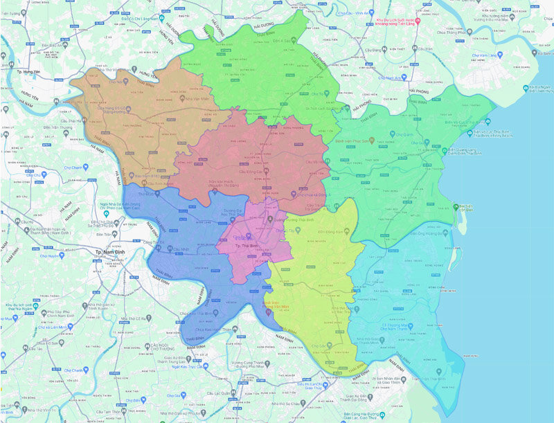
Thai Binh is a province in Northern Vietnam, currently has 8 district-level administrative units under it. Including: Thai Binh City and 7 districts: Tien Hai, Kien Xuong, Dong Hung, Quynh Phu, Hung Ha, Thai Thuy, Vu Thu.
Map of Yen Bai province
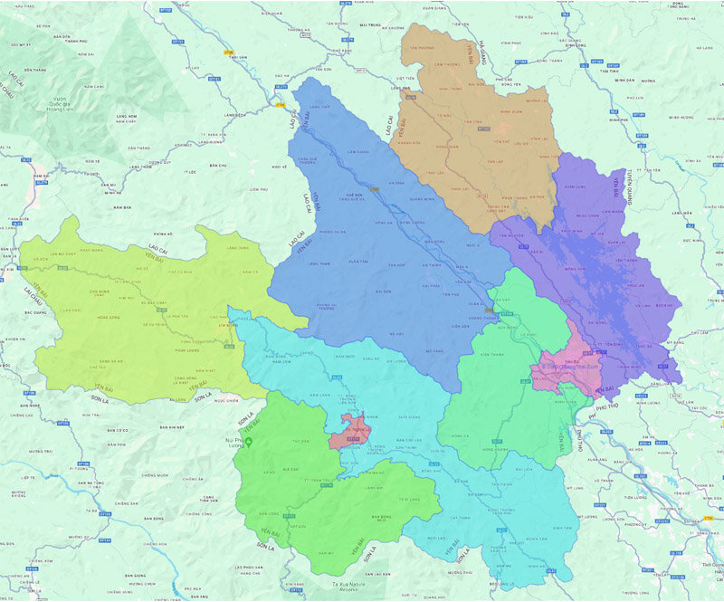
Looking on the map of the North, Yen Bai province is currently divided into 9 district-level administrative units. These include: Yen Bai City, Nghia Lo Town and 7 districts: Van Yen, Mu Cang Chai, Luc Yen, Tram Tau, Yen Binh, Tran Yen, Van Chan.
Map of Phu Tho province
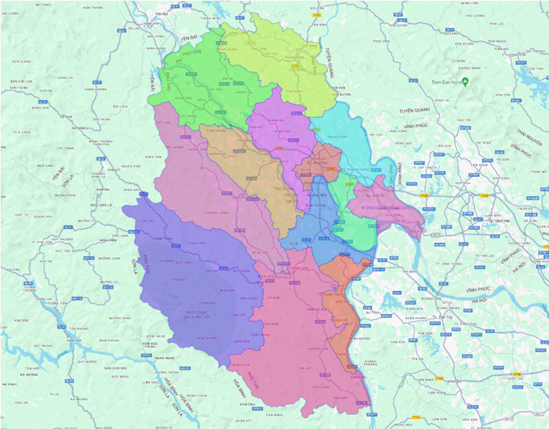
Phu Tho province currently has 13 district level administrative units under it Including: Viet Tri city, Phu Tho town and 11 districts: Thanh Son, Cam Khe, Tan Son, Lam Thao, Doan Hung, Phu Ninh, Thanh Thuy, Ha Hoa, Tam Nong, Thanh Ba, Yen Lap.
Map of Tuyen Quang province
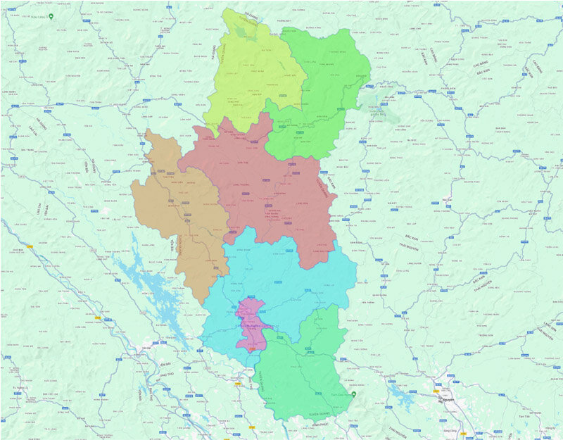
Currently, Tuyen Quang province is divided into 7 district level administrative units. Which includes Tuyen Quang city and 6 districts: Son Duong, Ham Yen, Na Hang, Lam Binh, Chiem Hoa, Yen Son.
Map of Bac Giang province
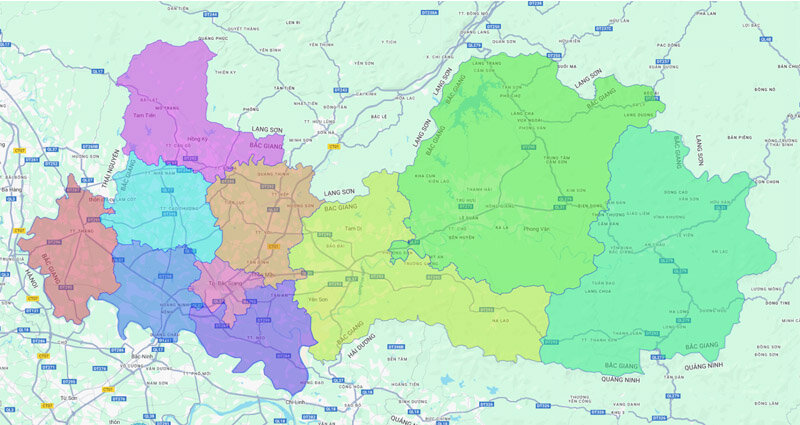
Bac Giang province currently has 10 district level administrative units, including: Bac Giang city and 9 districts: Son Dong, Luc Ngan, Hiep Hoa, Luc Nam, Yen Dung, Tan Yen, Viet Yen, Lang Giang, Yen The.
Map of Hai Phong city
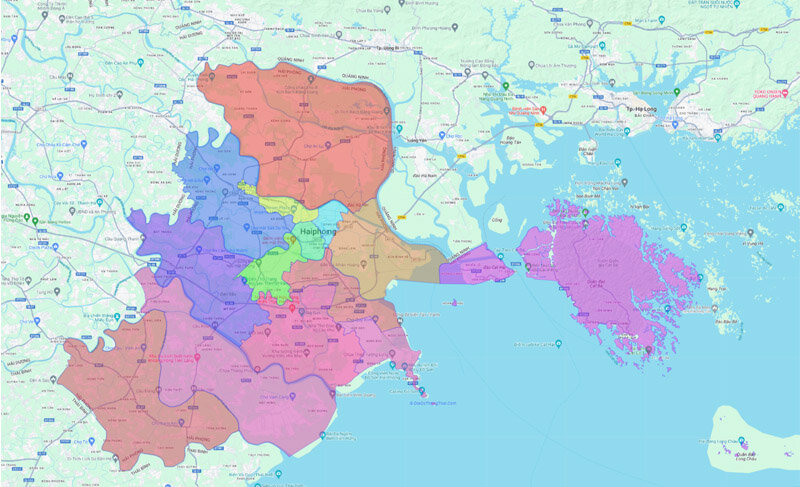
Hai Phong is one of five centrally run cities in Vietnam, divided into 15 district level administrative units. This includes 7 districts: Le Chan, Do Son, Duong Kinh, Kien An, Hong Bang, Ngo Quyen, Hai An and 8 districts: Kien Thi, Cat Hai, An Duong, Tien Lang, Bach Long Vi, Thuy Nguyen, An Lao, Vinh Bao.
Northern Vietnam, with its 25 provinces and cities, is the cradle of culture and history, where majestic natural landscapes and ancient cultural heritage converge. From bustling, modern cities to tranquil, traditional countryside areas, each province and city possesses its own unique charm, contributing to the diverse and captivating tapestry of Northern Vietnam.
I hope this article has provided you with an overview of the 25 provinces and cities in Northern Vietnam, helping you gain a better understanding of the culture, history and development potential of each locality.
Explore more information on the office rental market to find the ideal location for your business

